Friday
11 April, 2025
RANGPUR, Oct 2, 2024 (BSS) - Normalcy started returning to the flood-hit areas following further improvement of the short-term deluge situation in the last 24 hours till 9am today in the Brahmaputra basin.
Officials of Bangladesh Water Development Board (BWDB) said major rivers were flowing below danger marks (DM) at all points today following further reduction in the rate of onrushing water from upstream amid no rainfalls during the period.
Officials of the local administrations said relief activities have been intensified to mitigate the sufferings of flood-hit people despite the recession of floodwater from affected areas.
There is no flood situation now in Rangpur, Nilphamari, Lalmonirhat, Kurigram and Gaibandha districts although complete normalcy will return in low-lying, char areas within the next few days.
Talking to BSS, Chief Engineer for Rangpur Zone of BWDB Md. Mahbubur Rahman said that there is no flood situation as water levels of all rivers were flowing much below their respective danger marks (DM) at all points in the basin at 9 am today.
In the meantime, more incidents of sporadic riverbank erosion are being reported from several areas along major rivers in Kurigram, Gaibandha and Lalmonirhat districts.
"We are conducting riverbank protection works on an emergency basis at some vulnerable points in Lalmonirhat, Kurigram and Gaibandha districts," he said.
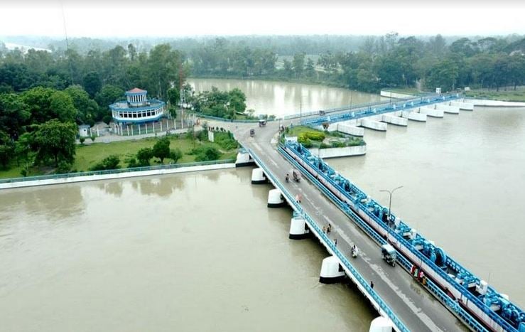
Meanwhile, water levels of the Teesta marked fall by 19cm at Kawnia point in Rangpur while rose by 10cm at Dalia point in Nilphamari during the last 24 hours ending at 9am today.
"The Teesta was flowing 54cm below DM at Kawnia point and 45cm below DM at Dalia point at 9am today," The Chief Engineer said.
Following further sharp falls in their water levels, the Dharla was flowing below DM by 261cm at Kurigram while Dudhkumar was flowing below DM by 122cm at Patweshari point in Kurigram at 9am today.
The Brahmaputra was flowing below DM by 285cm at Noonkhawa, 322cm at Hatia and 289cm at Chilmari points in Kurigram at 9 am today.
The Jamuna was flowing below DM by 330cm at Fulchhari, 278cm at Shaghata, 296cm at Bahadurabad, 285cm at Sariakandi, 291cm at Kazipur and 250cm at Sirajganj points in the basin at 9 am today.
"The falling trend in water levels of major rivers continues at all points amid no rainfalls during the last 24 hours in Rangpur, Lalmonirhat, Nilphamari, Kurigram and Gaibandha districts under BWDB's Rangpur zone," Engineer Rahman said.
Additional Director of the Department of Agricultural Extension (DAE) for Rangpur region Md Obaidur Rahman Mondal said standing crops on 1,616 hectares of land were submerged under floodwater in 17 upazilas of five districts in greater Rangpur this time.
Floodwater has already receded from all the submerged crop fields in low-lying and char areas of these districts in the region.
"For quicker recession of floodwater from croplands within three to four days since submergence, crop damages would be the minimum only in case of submerged vegetables, onion and Mashkalai while Aman rice will not be affected," he said.
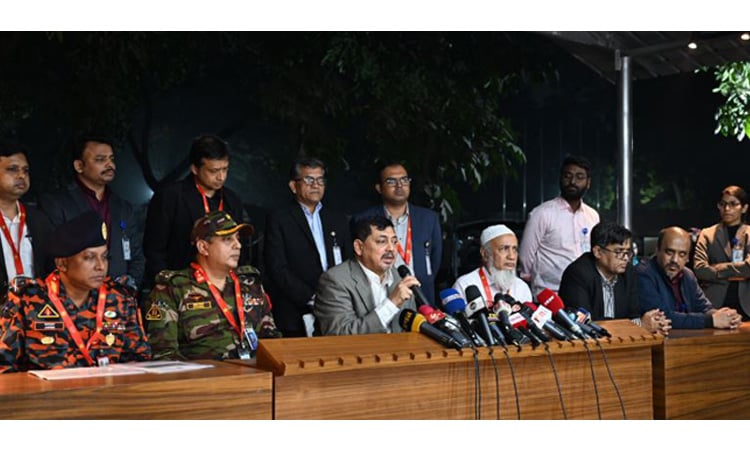
Acting Rangpur Divisional Commissioner Md. Azmal Hossain today told BSS that the deluge situation improved further with continuous recession of floodwater during the last two days from the inundated areas in all five districts of greater Rangpur.
"Despite improvement in the flood situation, the district administrations are conducting relief activities to stand beside the flood-hit people of affected districts and mitigate their sufferings," he said.
The BWDB officials, district and upazila administrations are closely monitoring the flood and river erosion situation in deluge-prone areas in all five districts of greater Rangpur.
"The Deputy Commissioners and UNOs are still closely monitoring the flood and river erosion situation as normalcy has already started returning to flood-hit districts," he added.